Документы
В этом разделе представлены общедоступные документы и файлы, загруженные заинтересованными сторонами и хранителями окружающей среды Каспийского моря.
 Национальный Доклад по выполнению Тегеранской Конвенции за 2019-2022 гг. (Туркменистан)ср, 09/06/2023 - 19:38
- Attached documents
- Metadata
- Год
- 2023
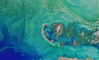
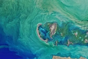
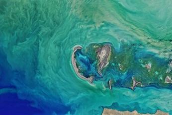
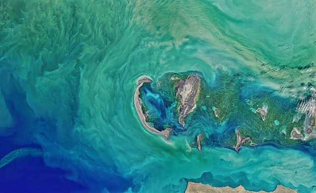
 Колебания уровня каспийского моря и диагностика современных изменений положения береговой линии по спутниковым данным Landsat периода 2005…2015 годовчт, 08/09/2018 - 13:45Рассмотрены вопросы, связанные с проблемой колебаний уровня Каспийского моря и их влияний на прибрежную зону казах-станского сектора. По данным картирования спутниковых снимков площадь осушения в северо-восточной части Каспийского моря в период между 2005 и 2015 гг. составила 5055 км2. В некоторых районах море отступило на 2
- Описание
Рассмотрены вопросы, связанные с проблемой колебаний уровня Каспийского моря и их влияний на прибрежную зону казах-станского сектора. По данным картирования спутниковых снимков площадь осушения в северо-восточной части Каспийского моря в период между 2005 и 2015 гг. составила 5055 км2. В некоторых районах море отступило на 25 км
- Attached documents
- Metadata
- Год
- 2015
 Article - Long-term and seasonal Caspian Sea level change from satellite gravity and altimeter measurementsпн, 07/16/2018 - 15:43The article examines recent Caspian Sea level change by using both satellite radar altimetry and satellite gravity data. The altimetry record for 2002–2015 shows a declining level at a rate that is approximately 20 times greater than the rate of global sea level rise. Seasonal fluctuations are also much larger than in the wo
- Описание
The article examines recent Caspian Sea level change by using both satellite radar altimetry and satellite gravity data. The altimetry record for 2002–2015 shows a declining level at a rate that is approximately 20 times greater than the rate of global sea level rise. Seasonal fluctuations are also much larger than in the world oceans. With a clearly defined geographic region and dominant signal magnitude, variations in the sea level and associated mass changes provide an excellent way to compare various approaches for processing satellite gravity data.
- Attached documents
- Metadata
- Год
- 2017
- Statistical Yearbook, Kazakhstan in 2011пн, 07/09/2018 - 11:55Statistical data of the Republic of Kazakhstan
- Описание
Statistical data of the Republic of Kazakhstan
- Attached documents
- Metadata
- Год
- 2011
- Национальный доклад Республики Казахстан о выполнении по Тегеранской конвенции по защите морской среды Каспийского моря за 2017 годвс, 07/08/2018 - 23:06Обзор деятельности Казахстана по выполнению обязательств по Тегеранской конвенции
- Описание
Обзор деятельности Казахстана по выполнению обязательств по Тегеранской конвенции
- Metadata
- Год
- 2017
- Мониторинг геосферных процессов казахстанской части Каспиявс, 07/08/2018 - 22:22статья КазНУ Вестник
- Описание
статья КазНУ Вестник
- Attached documents
- Metadata
- Год
- 2009
 Average Precipitation & Evaporation in the Caspian Sea 2000-2015вт, 06/12/2018 - 10:53Average precipitation and evaporation in the Caspian Sea in 2000-2015. Created by Manana Kurtabadze.
- Описание
Average precipitation and evaporation in the Caspian Sea in 2000-2015.
Created by Manana Kurtabadze.
- Attached documents
- Metadata
- Год
- 2018
 Article - Effects of Caspian Sea water level fluctuations on existing drainsпн, 04/23/2018 - 19:18This study is an attempt to develop an integrated methodology to predict the impact of the Caspian Sea on flooding using Geographic Information Systems (GIS) and hydrodynamic modeling. A rise in the sea level might lead to major flooding events, and have a severe impact on the spatial development of cities and regions. The f
- Описание
This study is an attempt to develop an integrated methodology to predict the impact of the Caspian Sea on flooding using Geographic Information Systems (GIS) and hydrodynamic modeling. A rise in the sea level might lead to major flooding events, and have a severe impact on the spatial development of cities and regions. The feasibility of simulating a flood event along a drain channel is evaluated near residential development areas along the Chapakroud drain.
The study shows that at these elevations environmental and social problems arise with regards to the drain. The results also indicate that GIS is an effective tool for floodplain visualization and analysis. It should be noted that the mixture of salt and soft water, as a result of rising sea water level, is a problem that was not investigated in this study and should be examined in the future.
- Attached documents
- Metadata
- Год
- 2011
- National Caspian Action Plan of Azerbaijan Republicпт, 04/20/2018 - 15:31
- Attached documents
- Metadata
- Год
- 2007
- Statistical Yearbook of Azerbaijan 2015пт, 04/20/2018 - 15:25Being an annual official statistical issue reflecting processes occurred in social, economic, demographic and ecological life of the country the yearbook is prepared based on data of statistical report forms, censuses, sample surveys and other statistical observation forms received by statistical bodies from enterprises, org
- Описание
Being an annual official statistical issue reflecting processes occurred in social, economic, demographic and ecological life of the country the yearbook is prepared based on data of statistical report forms, censuses, sample surveys and other statistical observation forms received by statistical bodies from enterprises, organizations, households and natural entities as well as from ministries, committees, departments and international organizations.
The Statistical Yearbook reflecting social-economic indicators of 2014 in comparison with indicators of 2005-2013 will meet data requirements of widerange of readers and other users.
- Attached documents
- Metadata
- Год
- 2015
Документ

Национальный Доклад по выполнению Тегеранской Конвенции за 2019-2022 гг. (Туркменистан)
Документ
Колебания уровня каспийского моря и диагностика современных изменений положения береговой линии по спутниковым данным Landsat периода 2005…2015 годов
Документ

Article - Long-term and seasonal Caspian Sea level change from satellite gravity and altimeter measurements
Документ
Statistical Yearbook, Kazakhstan in 2011
Документ
Национальный доклад Республики Казахстан о выполнении по Тегеранской конвенции по защите морской среды Каспийского моря за 2017 год
Документ
Мониторинг геосферных процессов казахстанской части Каспия
Документ
Average Precipitation & Evaporation in the Caspian Sea 2000-2015
Документ